Normal view

Climate change may shift hailstorms towards Earth’s poles – new study

Warren Faidley/Getty Images

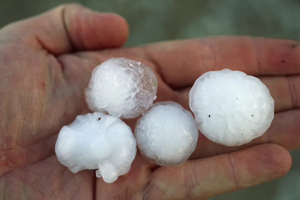
Everyone has a storm story – whether it’s that time you just escaped a downpour, or the hailstorm that wrote off your car. Even though hailstorms are relatively rare, they cause significant damages. Two new studies shed light on how hail might change as the world warms.

In our study, published today in Nature Climate Change, we show that hail conditions may move towards the poles with global warming and shift a bit from summer to winter. This could lead to more hailstorms in places such as northern Europe, Canada, southeastern Australia and New Zealand’s South Island.

Another new study led by Shiyi Zhang at Peking University shows that hail may also become more damaging.

Hailstorms are costly. In Australia in 2025, hail in New South Wales and Queensland caused A$1.9b in insurance claims, and in recent years severe storms have caused enormous losses globally.

Severe storm costs are increasing. Much of this increase is because people and assets are more exposed to storms as populations increase and cities expand.

But is climate change also playing a role?

How does hail form?

To get hail you need a thunderstorm, and to get a thunderstorm you need an updraught. Updraughts form when buoyant air rises in a localised area. They bring up water vapour, which condenses into clouds made of tiny water droplets.

Inside a storm those drops hit each other, and if it’s cold enough, liquid drops freeze onto ice particles, growing them into hailstones.

For hail to affect us at ground level, a strong updraught needs to keep hailstones aloft for long enough to grow, and the hailstones must then survive melting as they fall to Earth’s surface.

Wind shear, or shifts in wind with height, increases storm severity by moving falling rain and hail away from the updraught, so the updraught is not inhibited and can grow stronger.

Buoyancy and wind shear form the basic atmospheric “ingredients” required for hail.

How might climate change affect hailstorms?

Climate change is warming the atmosphere and adding moisture to it. Moisture is the fuel for storms, and a warmer atmosphere is more likely to make strong updraughts that can support larger hail.

A warmer atmosphere also melts falling hail faster, which might make hailstones shrink or melt away before they reach the ground. So, these two changes work against each other.

According to past research, the broad expectation of climate change’s impact on hail is that it will bring less frequent hail, but the hailstones will be larger when hail does happen. That’s because more melting would mean smaller hail reaches the ground less often, but stronger updraughts would enable larger hailstones.

However, these changes vary regionally, depending on variations in the delicate balance between hailstorm ingredient changes.

Global climate models generally can’t tell us about individual storms, let alone hailstones – think of a low-resolution image that only shows the broad picture but no details.

So, instead of looking at hail directly, our study examined how the ingredients for hailstorms change. Because the exact relationships between ingredients and hail risk remain unclear, we used several so-called “proxy” relationships, including one that we previously developed for Australia and the wide range of weather regimes here.

New global projections for hail frequency

We applied three proxies to outputs from eight climate models to look at a range of possible future warming scenarios.

First, the proxies and models agree that in the warming scenarios hail-prone conditions are shifting toward the poles – decreasing across mid-latitudes in the southern hemisphere, and increasing in mid-high latitudes, particularly in the northern hemisphere.

We project more frequent hail conditions in northern Europe, Canada and the northwestern US, southeastern Australia, and the South Island of New Zealand; and less frequent hail conditions in northern Australia, most of Africa, southern India and southeastern China.

Two maps of the world showing projected changes in hail-prone day frequency.
Changes in normalised annual hail-prone days in climate projections under 2 (a) and 3 degrees Celsius (b) of mean global warming. Red shows increases and blue shows decreases in hail-prone day frequency. Hatched areas are where there was more model and proxy agreement. For full details see Raupach et al., 2026. CC-BY, Tim Raupach, UNSW Sydney

Second, our results predict less frequent hail conditions in summer and more in winter. That means winter crops like wheat may see increasing risk, while risk may decrease for summer crops like maize. If climate change shifts arable regions closer to the poles, these crops may be subjected to increased hail frequency there.

Third, the different proxies don’t always agree, particularly in the tropics where some show increases and others decreases. These disagreements highlight the difficulties in estimating changes in hail environments and how that connects to whether hail happens.

Less frequent, but more damaging

What about the severity of hail when it occurs? Zhang and colleagues took a different approach to ours. They applied a model of hailstone growth and melting to climate simulations, to examine possible hail sizes and changes in potential damage they might cause.

Their new global simulations overall predict more large hailstones and fewer small ones. This result is in line with previous reasoning – a warmer atmosphere can melt smaller hailstones away but produce larger hail through stronger updraughts.

Like ours, their study shows regional differences in changes. Both studies show increasing hail risk with increased frequency and hail damage potential in the mid-high latitude northern hemisphere and southeastern South America.

In sub-tropical regions of Africa and northern South America, both studies show decreasing hail risk. In southeast US, mid-northern Africa, southern India, and northeastern Australia, we project decreasing frequency while Zhang and colleagues project increasing damage potential.

These two studies point to increasing risk from hail damage in a warming world, even though the details of where this will be experienced are still not clear. The more warming occurs, the more this risk will increase.

Quickly reducing greenhouse gas emissions is the surest way to blunt the most damaging effects of climate change.

The Conversation

Timothy H. Raupach's role at UNSW receives funding from QBE Insurance, which had no role in the design of this study. He receives funding for other projects from the Australian Research Council, Guy Carpenter, and Aon Japan.

Steven Sherwood receives funding from the Australian Research Council and the Minderoo Foundation.

Hurricane forecasts have improved dramatically, saving lives, but federal cuts threaten to stretch NOAA resources to breaking point

One of NOAA's WP-3D Orion hurricane hunters, dubbed Miss Piggy, flies over Tropical Storm Idalia on Aug. 28, 2023. Nick Underwood/NOAA

The 2026 Atlantic hurricane season starts June 1, and while early outlooks suggest that a developing El Niño might result in a tamer season than in the past few years, with below-average hurricane activity, all it takes is one big storm hitting a populated area to make it a bad hurricane season.

Every year, Americans rely on accurate forecasts when hurricanes might be developing to know when to stock up on supplies, prepare for power outages or evacuate.

Those forecasts have improved dramatically in recent decades, but the improvements can’t be taken for granted. Over the past year, federal funding cuts and job losses in the very programs that are helping make Americans safer from extreme weather threaten to stall progress and stretch forecasting resources to the breaking point.

How storm tracks have improved.
Hurricane track forecasts have become more accurate over the past three decades. For example, recent forecasts showing where a storm is expected to be in 96 hours have been, on average, about as accurate as a 24-hour track forecast was in the early 1990s. That gives people more time to evacuate. The lines show how many miles off the National Hurricane Center’s official storm tracks were. National Hurricane Center

I am an atmospheric scientist whose research focuses on hurricanes, including how and why they intensify or weaken. I also work with scientists at the National Oceanic and Atmospheric Administration, NOAA, to analyze observations collected by reconnaissance aircraft and evaluate computer model forecasts of hurricanes.

Here’s what forecasters rely on during hurricane season and why investing in science, forecasting technologies and the people who run them matters.

Flying through hurricanes

To have the best chance of an accurate hurricane forecast, computer models and meteorologists need to know about the location, intensity and structure of a hurricane, along with the environment that surrounds it. Satellites are crucial for tracking storms from above, but many details can be collected only inside the storm, where satellites can’t see.

That’s why NOAA relies on “hurricane hunters” – a group of skilled pilots and scientists who fly through storms all season long to collect storm data, which is quickly transmitted to forecasters and computer models.

A scientists in a flight suit sits at a computer in an airplane talking on a headset.
Flight Director Quinn Kalen at his work station during a flight into Hurricane Lee on Sept. 8, 2023. Lt Cmdr Utama/NOAA Corps
A radar screen with an airplane in the center of a storm circulation.
A radar display shows NOAA’s Miss Piggy hurricane hunter aircraft in the center of Tropical Storm Idalia on Aug. 28, 2023. Nick Underwood/NOAA

When storms are developing, the U.S. Air Force Reserve and NOAA conduct several hurricane hunter flights per day to provide the most up-to-date storm information. During these missions, the crews often fly directly into the storm, through screaming winds and heavy rain, to release instrument packages called dropsondes.

The dropsonde is a feat of science and engineering, able to accurately measure the temperature, humidity, wind and pressure in hostile conditions. This data is radioed back to the aircraft. From there, it is processed and transmitted to NOAA, where forecasters analyze it and computer models use it to initialize forecasts.

A NOAA scientist explains how hurricane forecasters use dropsondes.

I and many hurricane scientists have used dropsonde data collected over the years to build a better understanding of how hurricanes behave. A recent study showed that computer model forecasts of hurricane tracks were up to 24% more accurate when they included dropsonde data than those that didn’t.

Simulating hurricanes

A big reason hurricane forecasts have gotten better has been federal investments in computer models that can simulate these storms.

In 2008 the U.S. government funded the NOAA Hurricane Forecast Improvement Project, leading to substantial advancements in computer modeling and forecast accuracy. Computer models got better at incorporating the observations gathered by aircraft, showing air movements and rain bands in greater detail.

A radar showing a hurricane's swirling form.
A HAFS radar forecast shows Hurricane Melissa as it approaches Jamaica in October 2025. The HAFS model performed well in forecasting the intensification and extreme strength of the Category 5 storm in the days leading up to its landfall in Jamaica. NOAA/AOML/HRD

The flagship NOAA hurricane model is now the Hurricane Analysis and Forecast System, which does a better job of predicting rapid intensification, among other things, than its predecessors.

When storms rapidly intensify, as several have done in recent years, they can pose an acute risk to coastal communities. More accurate forecasts give people and communities better information to decide how to prepare and when they need to evacuate. Improvements since 2007 have resulted in an estimated US$2 billion in savings per hurricane landfall and many lives saved.

That’s a huge return on investment. In 2024, NOAA’s entire budget was $6.7 billion.

Keeping an eye on the storms ahead

There are some exciting developments ahead in hurricane observations and modeling.

NOAA in 2024 ordered two new aircraft, expected to be delivered by 2030, to begin replacing its aging hurricane hunter fleet so fights and their data collection can continue.

Private companies working with NOAA have deployed and tested autonomous drones – both in the air and sail drones on the ocean surface – that can collect data in areas where quality observations are hard to get.

Additionally, artificial intelligence weather models have emerged, such as Google DeepMind, which made a big splash as the most accurate forecast model of the 2025 hurricane season.

Some lingering dark clouds

Despite these promising developments, a different storm is eroding the bedrock upon which the national weather forecast enterprise sits.

Cuts in funding and staffing have stressed NOAA’s ability to collect critical observations. Last year, retired NOAA scientists volunteered to staff hurricane hunter reconnaissance flights so the missions could still be flown.

Debris and damage homes across a town with the Gulf waters in the background.
Knowing when to evacuate is crucial. Hurricane Helene made a mess in Horseshoe Beach, Fla., on Sept. 28, 2024. The storm was blamed for at least 250 deaths across six states. Chandan Khanna/AFP via Getty Images

The Trump administration proposed cutting NOAA’s budget by more than a quarter, including dismantling its Office of Oceanic and Atmospheric Research. Congress rejected many of the administration’s proposed budget cuts, ultimately approving a $6.1 billion budget in March 2026, still down from the previous budget.

The National Center for Atmospheric Research, which led the development of computer models and dropsonde technology, has also been targeted by the Trump administration to be dismantled. The American Meteorological Society warns this decision “will harm meteorological research and innovation in the United States with severe consequences to current and future efforts of the weather enterprise to protect life, property, and the nation’s economy.”

I worry about the funding and staff cuts stressing systems that keep scientific progress marching forward and warn Americans about hazardous weather. Losing staff and support raises the risk of critical failures, such as delayed severe weather warnings and broken equipment causing new blind spots when storms threaten. In the long run, failing to invest risks stagnation or even reversing the hard-fought progress the U.S. has made in advancing weather prediction.

With coastal populations and development expanding over the past few decades, and storms becoming stronger, the vulnerability of the U.S. to costly, damaging hurricanes has increased dramatically. It is more important than ever that public investment in hurricane science and forecasting continue.

This article, originally published May 18, 2026, has been updated with NOAA’s 2026 Atlantic Hurricane Season outlook.

The Conversation

Brian Tang receives funding from the National Science Foundation, the National Aeronautics and Space Administration, and the Center for Western Weather and Water Extremes. He has research collaborations with the National Oceanic and Atmospheric Administration's Hurricane Research Division. He is a member of the American Meteorological Society.

❌
Subscriptions