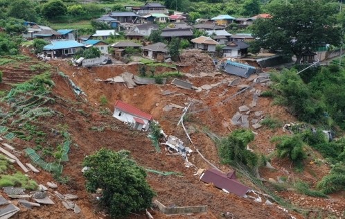
On the growth of research in landslides
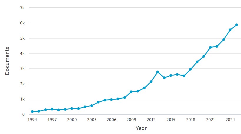
Since 1994 there has been a 32 times increase in the number of research outputs with the keyword “landslide”.
In a couple of weeks time, I have the pleasure of being one of the invited speakers at the Landslide Risk and Geoengineering (LaRGE) Conference in Queenstown, New Zealand. Ahead of that presentation, I’ve been using Scopus to look at the growth of research in landslides since 1994, the year that I submitted my PhD thesis.
This graph, from Scopus, shows the number of research outputs per year that use the keyword “landslide”. It is simple and unfiltered:-
The extraordinary growth in productivity is clear – to put it into context, in 1994 the number of outputs was 182; in 2025, it was 5,875, a 32x increase. This is a remarkable improvement in the volume of our understanding of landslides, although it does not say anything about paradigm change.
It is interesting to look at some of the key publications for landslide research:-
The journal Landslides started in 2004 and has shown remarkable growth (although note it still represents a tiny proportion of the total outputs per year). There are also large increases in the journals Natural Hazards and Engineering Geology, and a smaller increase for journal Geomorphology. On the other hand, those journals that traditionally would have been associated with landslide research, such as QJEGH, Canadian Geotechnical Journal and Geotechnique, have remained essentially static over time.
I suspect that this represents a growth in the academic areas researching landslides, and in particular a diversification from geotechnical engineering to a much more broader range of research that encompasses people with an interest in geomorphology, remote sensing, geophysics and natural hazards.
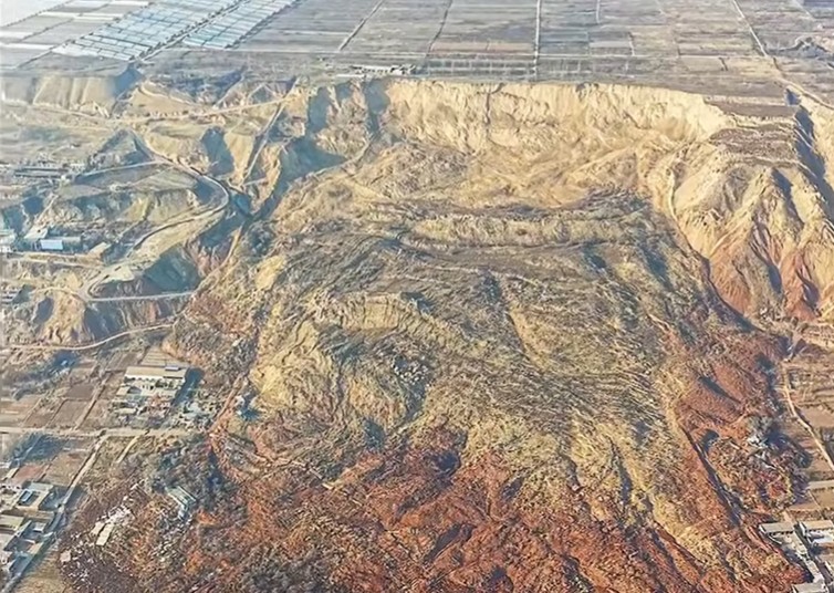
There is one other element that is important here too, which is the growth of landslide research in China. This graph shows the same data as above but with China as the national affiliation of one or more author:-
The growth in landslide research productivity in China is explosive over the last ten years, and with 2,616 outputs in 2025, Chinese affiliated authors are now producing over 55% of the world’s landslide research. There is no doubt as to where the centre of gravity now lies in landslide science.