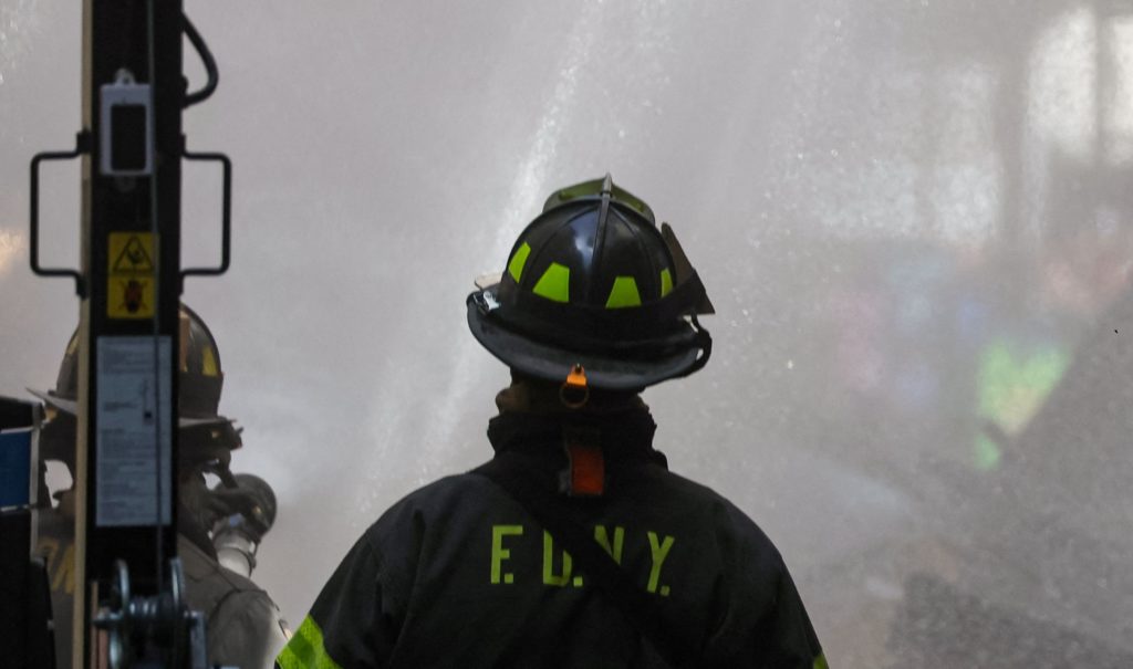
Someone reported two workers trapped in a confined space at the dock at about 3:30 p.m. Friday, and responding firefighters found a fire burning in the basement of a large metal structure at the dock, said Joanne Mariano with the New York Fire Department's press office.
Someone reported two workers trapped in a confined space at the dock at about 3:30 p.m. Friday, and responding firefighters found a fire burning in the basement of a large metal structure at the dock, said Joanne Mariano with the New York Fire Department's press office.
The Fire Hills First Nations Police Service said charges are being laid against a 25-year-old man from the community following a wildfire earlier this month.
The Fire Hills First Nations Police Service said charges are being laid against a 25-year-old man from the community following a wildfire earlier this month.
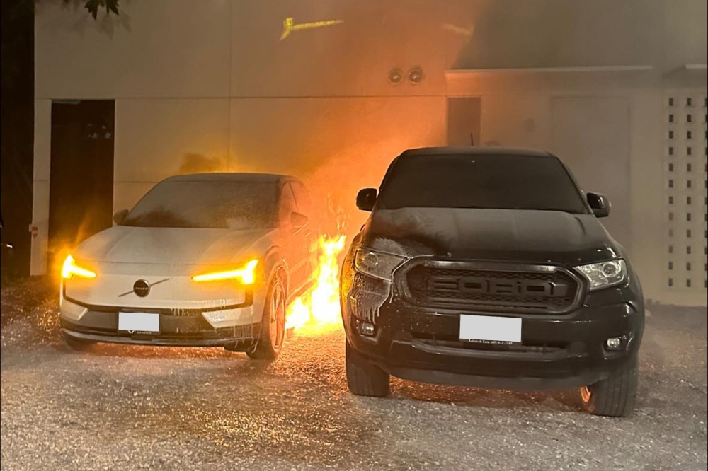
BANGKOK, May 21 — Thailand’s consumer watchdog will file a civil suit against the local unit of Volvo Cars over battery-related fires in its EX30 model, a senior official told Reuters after a meeting between customers and the carmaker failed to reach an agreement.“The Office of Consumer Protection Board reached a resolution to file a suit for damages, including refunds,” Pradoemchai Bunchualuai, who chaired today’s meeting, told Reuters by phone.Pradoemchai, who
BANGKOK, May 21 — Thailand’s consumer watchdog will file a civil suit against the local unit of Volvo Cars over battery-related fires in its EX30 model, a senior official told Reuters after a meeting between customers and the carmaker failed to reach an agreement.
“The Office of Consumer Protection Board reached a resolution to file a suit for damages, including refunds,” Pradoemchai Bunchualuai, who chaired today’s meeting, told Reuters by phone.
Pradoemchai, who is an adviser to Thailand’s prime minister’s office, said the OCPB would run the civil suit on a case-by-case basis.
The decision to take court action follows two EX30 fires in the country this month, and adds to pressure on the Swedish carmaker as it tries to manage a global recall of its electric SUV.
Volvo Cars’ Thailand unit did not immediately respond to a request for comment about the suit. There are over 1,600 EX30s in Thailand.
A Volvo Cars spokesman had previously said that the incidents remain rare, with fires reported in 0.1 per cent of affected vehicles. Volvo Cars has issued notices to customers to not charge their battery beyond 70 per cent as an interim measure.
Pradoemchai said Volvo Cars had proposed battery replacements and the use of temporary vehicles for 90 per cent of those impacted and partial replacements for the rest, but that was not accepted by customers.
“Most consumers want a full refund and not battery replacements,” EX30-owner Tanchanok Nowsuwan, who attended the meeting, told reporters.
Reuters reported in February that Volvo would recall more than 40,000 EX30s and replace battery modules due to a defect that could cause packs to overheat and potentially catch fire. The Volvo Cars spokesman said the global recall has been reduced to 37,802 cars from 40,323. — Reuters
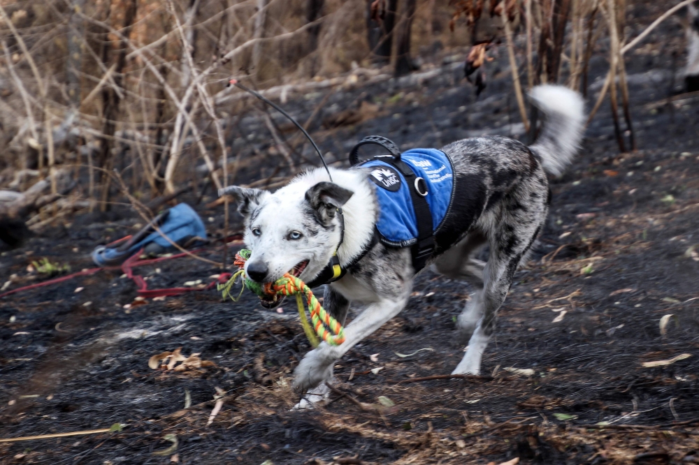
SYDNEY, May 20 — An Australian animal welfare group is seeking a heroic dog with an appetite for adventure for a full-time position as a koala rescuer.The successful pooch will replace the world-famous Bear, credited with saving over 100 koalas from bushfires during a decade of service.“Bear set the gold standard for koala detection dogs,” the International Fund for Animal Welfare (IFAW) Oceania head of programmes Josey Sharrad said.“He’s leaving very big boots t
SYDNEY, May 20 — An Australian animal welfare group is seeking a heroic dog with an appetite for adventure for a full-time position as a koala rescuer.
The successful pooch will replace the world-famous Bear, credited with saving over 100 koalas from bushfires during a decade of service.
“Bear set the gold standard for koala detection dogs,” the International Fund for Animal Welfare (IFAW) Oceania head of programmes Josey Sharrad said.
“He’s leaving very big boots to fill, but now it’s time to find his successor to follow in his pawprints and keep protecting koalas.”
The ideal candidate will be a rescue pup with a lot of energy and an “obsessive” personality — attributes that might make it hard to find a home but which make it perfect for saving koalas, IFAW said.
“By only recruiting a rescue dog, it’s a win-win — giving a dog the chance of a new life while helping our iconic koalas,” Innovation for Conservation director and handler Russell Miller said.
Other key attributes are a love of play, confidence and a gentle temperament towards fellow animals is crucial.
They must also be medium sized — “not too small that they struggle in the bush, not too big that the handlers can’t carry them when needed”, according to the IFAW job ad.
Interviews were being held in eastern Australia’s Sunshine Coast but applications by video are also welcome.
Bear’s skills saved over 100 koalas as the Black Summer bushfires raged across Australia’s eastern seaboard from late 2019 to early 2020, razing millions of hectares, destroying thousands of homes and blanketing cities in noxious smoke.
The tail-wagging detective with a “joyful and goofy” personality retired with an extensive list of accolades — including an Animal of the Year award and Puppy Tales Photos Australian Dog of the Year award. — AFP
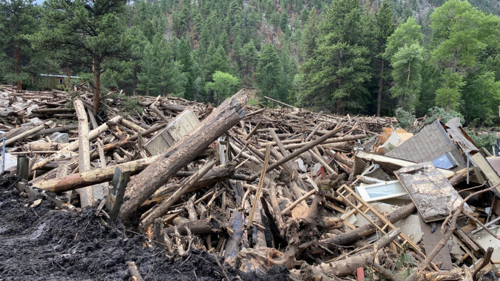
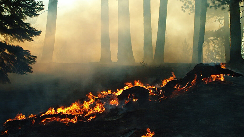
Months after wildfires eliminate vegetation that holds hillside sediment together, debris flows—destructive landslides that carry bulky material down once-stable slopes—can devastate infrastructure, taking out roads and buildings in their wake.
Though the U.S. Geological Survey (USGS) creates hazard predictions used to warn communities of the risk of these postfire debris flows, those predictions haven’t fully considered how recovering vegetation reduces risk over time—until now.
A new study published in Geosphere presents a new way to calculate postfire debris flow risk that takes vegetation recovery into account. The USGS will begin using the new method this wildfire season to create more accurate maps of debris flow hazard in the years after a fire.
“I’m so appreciative that the focus on how the debris flow hazard changes over time after fire is being addressed,” said Nancy Calhoun, a geologist and postwildfire debris flow program manager at the Washington Geological Survey who was not involved in the new study. Calhoun said she relies on the USGS hazard assessments for virtually everything her job requires.
“We’re glad to have a way that we can help our partners moderate those situations where the hazard has decreased,” said Andrew Graber, a geologist at the USGS Landslide Hazards Program and lead author of the new study.
Assessing Hazard, Again
After a wildfire, the USGS creates hazard maps that incorporate information about soil type, steepness, and burn severity (how much vegetation has been lost) to show where the risk of a debris flow may be elevated.
Then, the agency distributes this guidance to the National Weather Service, which uses it to set rainfall thresholds: levels of rainfall at which a debris flow becomes likely. State, county, and city agencies use those rainfall thresholds to issue warnings or take action when rainfall is imminent, for example, by closing highways or triggering evacuations.
“That left us with some uncertainty when we started to get further away in time from the fire.”
The methods used to create the USGS maps, however, historically relied on a snapshot of the burned area taken just after the fire, and the maps weren’t updated to reflect conditions as vegetation grew back and began holding soil in place again.
That led to situations where public safety decisions were made on the basis of outdated maps and rainfall thresholds. For example, concern over debris flows after the 2020 Grizzly Creek Fire in Colorado led to several closures of Interstate 70 in 2022, but the debris flows never happened.
“What [the original assessments] didn’t capture is how the vegetation came back,” Graber said. “That left us with some uncertainty when we started to get further away in time from the fire.”
Intense rainfall in July 2025 triggered a debris flow near Dayton, Wyo., in the 2024 Elk Fire burn area. Credit: USGS, Public Domain
To test an improved method for these hazard assessments, Graber and the research team incorporated satellite imagery of 12 burned areas that showed the degree of vegetation recovery right after the fire, 1 year after the fire, and 2 years after the fire. Then, they tested their new method by comparing its predictions to rainfall and debris flow data from the 12 burned areas.
The updated method better reflected what had actually happened after the fires, reducing the number of unnecessary warnings without missing real-world debris flows.
Risk Recalibration
The USGS plans to begin using their new workflow to create hazard maps for some higher-profile fires during the coming wildfire season.
“It’s a really important question: Are we still worried about this burn scar?”
That’s exciting for Calhoun. As part of her job, she’s in constant contact with emergency managers who periodically ask how worried they should be about debris flows in areas that burned years ago. “It’s a really important question: Are we still worried about this burn scar?” she said.
Right now, Calhoun has no data to point to in the years after a fire to give an updated answer to that question. Using the new method from Graber and the research team, she will.
“Because they’re using satellite [imagery] and repeatable quantitative methods to look at these burn scars over time, we’ll actually be able to say something useful and informed about vegetation recovery,” she said.
Having a deeper understanding of how debris flow risk evolves over time is especially important because debris flows themselves are becoming a greater risk to the public as a result of increasingly intense wildfires and rainstorms. In addition, more accurate assessments can reduce warning fatigue, which occurs when too many false alarms lead to people ignoring or opting out of alerts.
Graber hopes he and the USGS will continue to improve their methods for assessing debris flow hazards by collecting more debris flow data across the country and improving the underlying equation for hazard assessments so that it better reflects the unique conditions of different ecosystems in the United States. USGS researchers also published a new study in March presenting a method to generate maps of where debris flows might travel if they do occur.
“It’s a big year for USGS’s useful postfire products,” Calhoun said.
This news article is included in our ENGAGE resource for educators seeking science news for their classroom lessons. Browse all ENGAGE articles, and share with your fellow educators how you integrated the article into an activity in the comments section below.
Citation: van Deelen, G. (2026), A new approach can better predict debris flow hazards years after fires, Eos, 107, https://doi.org/10.1029/2026EO260160. Published on 19 May 2026.
Source: AGU Advances
Across the western United States, wildfires are increasing in size and intensity. As the climate continues to warm, more extreme wildfires will reshape landscapes and pose a growing risk to human health and natural ecosystems throughout the West.
Climate models, used to predict other effects of climate change, are unable to directly simulate wildfires. Instead, researchers link previously burned areas to climate variables such as temperature, precipitation, drought, a
Across the western United States, wildfires are increasing in size and intensity. As the climate continues to warm, more extreme wildfires will reshape landscapes and pose a growing risk to human health and natural ecosystems throughout the West.
Climate models, used to predict other effects of climate change, are unable to directly simulate wildfires. Instead, researchers link previously burned areas to climate variables such as temperature, precipitation, drought, and evaporation, then apply those relationships to future climate projections.
Many recent studies have connected higher vapor pressure deficit (VPD)—a measure of atmospheric dryness—to more area burned in previous fires. VPD increases as the temperature rises, so models that rely on it generally predict an increase in wildfire activity as the climate warms.
Cheng et al. raise questions about the role VPD plays in modeling wildfire, suggesting that VPD is a poor measure of fuel dryness at larger scales and overestimates potential burned areas under significant warming conditions. Instead, researchers suggest soil moisture could be a more reliable indicator of fuel dryness and lead to more moderate projections of wildfire increases.
The researchers looked at five forested ecoregions in the western states. Using the Western US MTBS-Interagency wildfire dataset from 1984 to 2020 combined with climate data (temperature, VPD, and soil moisture), the researchers analyzed drivers of the area burned from May through October. They connected this information with output from climate models to look at future burn potential.
VPD-based wildfire predictions increase sharply under warming conditions. These predictions showed that under 3°C of average global warming, 16 times as much land would burn by the end of the century, compared to historical levels. Under 4°C of warming, up to 66 times more land would burn by the end of the century. This “truly massive” increase, the authors say, would mean fires consuming vegetation almost as soon as it regrows.
Soil moisture, on the other hand, provides a more moderate, though still concerning, picture. Under the same warming scenarios, soil moisture changes would lead to an increase in burned area of only 2–3 times that of the historical period. The researchers argue that projections relying on VPD severely exaggerate wildfire risk. (AGU Advances, https://doi.org/10.1029/2026AV002350, 2026)
Citation: Owen, R. (2026), How much will western wildfires worsen under warming?, Eos, 107, https://doi.org/10.1029/2026EO260147. Published on 15 May 2026.
chris murkin posted a photo:
G-ASJV RAF Supermarine Spitfire MkIXB MH434 ZD-B in the markings of 222 Squadron
The most famous of all Spitfires still flying today, MH434 was built in 1943 at Vickers, Castle Bromwich. This Spitfire is remarkably original, having never been subject to a re-build
Photo taken at Duxford 9th May 2026 Flying Day Show (DE Day)
HAA_1047