Normal view

  • ✇Eos
  • Tracing Water’s Hidden Journey Through the Earth’s Living Skin Andrea L. Popp and Harsh Beria
    Editors’ Vox is a blog from AGU’s Publications Department. Ensuring the sustainability of water resources and ecosystems in a changing world requires a thorough understanding of how water moves through Earth’s Critical Zone, a dynamic interface where air, water, soil, plants, and rocks interact. Researchers can track and model this movement of water using naturally occurring markers or “tracers.” A recent article in Reviews of Geophysics explores the latest advancements in tracer-aided mi
     

Tracing Water’s Hidden Journey Through the Earth’s Living Skin

13 May 2026 at 12:00
A river flowing through a mountainous region.
Editors’ Vox is a blog from AGU’s Publications Department.

Ensuring the sustainability of water resources and ecosystems in a changing world requires a thorough understanding of how water moves through Earth’s Critical Zone, a dynamic interface where air, water, soil, plants, and rocks interact. Researchers can track and model this movement of water using naturally occurring markers or “tracers.”

A recent article in Reviews of Geophysics explores the latest advancements in tracer-aided mixing models and how they can help us to better understand the Critical Zone. Here, we asked the authors to give an overview of the Critical Zone, how tracer-aided mixing modeling works, and future directions for research.

What is the Critical Zone (CZ)?

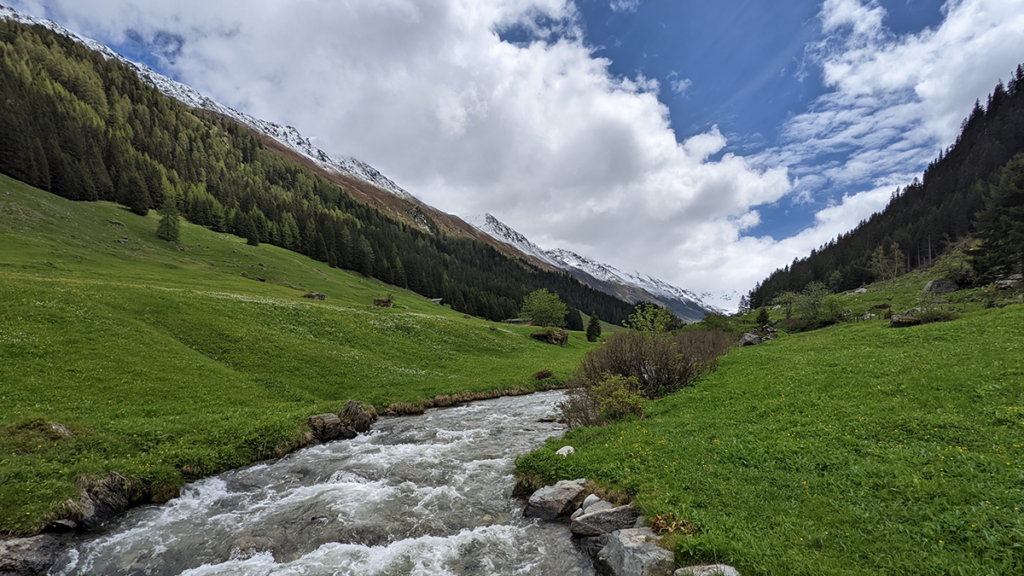
The Critical Zone is Earth’s “living skin”—the dynamic layer where the atmosphere, hydrosphere, biosphere, and lithosphere interact. It stretches from the top of the vegetation canopy and, in cold regions, from the surface of snowpacks and glaciers, down through soils and into the deeper aquifers. It encompasses lakes, streams, and wetlands at the surface, and extends beyond the soil layer to underlying groundwater aquifers. It is where rainfall, snowmelt and glacier melt become soil moisture, where plants take up water and return it to the atmosphere, where aquifers get recharged, and where streamflow is generated. In short, the Critical Zone is where most processes that sustain terrestrial life and freshwater resources unfold.

Why is it important to understand how water moves through the Critical Zone?

Virtually every freshwater resource we rely on (e.g., drinking water, irrigation) passes through the Critical Zone.

Virtually every freshwater resource we rely on (e.g., drinking water, irrigation) passes through the Critical Zone at some point. Global warming, land-use changes, and intensifying water demand emerging from rapid urbanization and changes in agriculture are reshaping how water is stored and released within the Critical Zone, often in ways we cannot yet predict. Understanding how much water is stored within the Critical Zone, how this water is both recharged from rainfall and snowmelt and eventually discharged into streams, and the timescale of these dynamic processes is essential for protecting ecosystems, safeguarding water supplies, and adapting to a changing climate.

How would you explain a tracer-aided mixing model to a non-specialist?

Imagine mixing a glass of orange juice with a glass of apple juice, and trying afterwards to work out how much of each went into the glass. If the juices had distinctive “fingerprints” (imagine its color, sugar content, or a specific chemical) and these fingerprints primarily changed because of the mixing of these two juices, you can then measure the fingerprint in the final mixture and back-calculate the proportion of its distinct sources.

Tracer-aided mixing models work in a similar way but can track the entire water cycle. Different water sources (e.g., rainfall, snowmelt, glacier melt, soil water, groundwater) can have distinct “fingerprints” in a naturally occurring tracer, such as stable isotopes of water or specific dissolved elements. By measuring these fingerprints in the streamwater or groundwater and in its potential sources for example, hydrologists can estimate how much each source contributed to the streamwater or groundwater.

Conceptual model of the different components of the Critical Zone. “Gw” stands for groundwater. Credit: Popp et al. [2025], Figure 2

What are some of the most significant and exciting recent advances in tracer-aided mixing models?

Classical mixing models relied on demanding assumptions: that all water sources can be identified and sampled, and that their signatures were distinct and constant in time. Much of the recent progress has been about relaxing these assumptions.

Bayesian approaches now estimate full probability distributions and provide a more realistic picture of uncertainty. Methods like Convex Hull End-Member Mixing Analysis (CHEMMA) use machine learning to infer the distinct sources directly from data, while ensemble hydrograph separation exploits tracer fluctuations over time, thereby making un-mixing feasible even when multiple sources have overlapping signatures. Perhaps the most conceptually novel advance is end-member splitting, which flips the question from “where does streamflow come from?” to “where does precipitation go?”

Alongside these modeling advances, there have been immense advances in how tracers are measured. Portable laser and mass spectrometers now enable high-frequency, in-situ tracer measurements which allows us to capture critical hydrological events such as storms and snowmelt in near-real time.

What are stable water isotope tracers and what are their advantages?

Stable water isotopes are naturally occurring non-radioactive atoms of hydrogen and oxygen that make up a water molecule but have slightly different molecular masses. The two stable isotopes widely used in hydrology are 2H (deuterium) and 18O (oxygen-18). Because these isotopes are part of the water molecule itself, they directly travel with the water molecule. Their key advantages are: (1) they are conservative, meaning they do not react chemically as water moves through soils and aquifers, and (2) they carry distinct signatures resulting from climatic variables such as air temperature.

These properties make stable water isotopes the most versatile and widely used tracer in Critical Zone hydrology.

Consequently, in the European Alps, winter precipitation has a different isotopic signature than summer precipitation because winters are cooler than summers. Other hydrological processes such as evaporation and sublimation leave a recognizable fingerprint on the remaining water, thereby allowing us to estimate how much evaporation or sublimation occurred. Stable water isotopes can be measured in essentially every water compartment, from atmospheric vapor and precipitation to snowpack, plant xylem, soil water, streams, and groundwater. Together, these properties make stable water isotopes the most versatile and widely used tracer in Critical Zone hydrology.

What are the current limitations of tracer-aided mixing models?

Despite their power, mixing models still face many constraints. End-member signatures vary in space and time, are sometimes too similar to distinguish, and some sources may be overlooked entirely. Non-conservative tracers such as nitrate or sulfate can react with their environment along their journey, thereby biasing results if these reactions are not explicitly accounted for.

Sampling is another major bottleneck. Capturing the spatial heterogeneity of soils, snowpacks, and groundwater requires a lot of measurements that are often logistically or financially prohibitive, especially in remote regions. Many of the newer, more powerful tracers such as noble gases or stable isotopes of trace elements, can only be analyzed by a handful of specialized laboratories. As a result, global coverage remains highly uneven, with key regions such as the Arctic and the global South still under-sampled.

What are some of the major unsolved questions and where is more research needed?

There are several fronts where more research is needed. Source signatures are not static, and methods that explicitly capture their variability in time are still underdeveloped. Embedding tracers within global Earth System Models would, in theory, enable more accurate assessment of hydrological partitioning e.g., how rainfall, snowmelt, and glacier melt are split between sublimation, evapotranspiration, groundwater, and streamflow. These will directly inform more robust climate projections, but this remains technically demanding.

Expanding data coverage in under-sampled regions is critical, and citizen science and low-cost sensors may help. Machine learning is a promising approach for uncovering non-linear relationships and gap-filling sparse datasets, but requires training data that often do not yet exist. Greater interdisciplinary integration, e.g., combining tracers with remote sensing, ecological indicators, and biogeochemical data, could yield a more holistic view of the Critical Zone. Finally, the field would benefit from shared protocols and open data practices to enhance progress.

—Andrea L. Popp (andrea.popp@smhi.se; 0000-0003-3911-8105), Swedish Meteorological and Hydrological Institute, Sweden; Harsh Beria (hberia@ethz.ch; 0000-0003-2597-9449), ETH Zurich, Switzerland

Editor’s Note: It is the policy of AGU Publications to invite the authors of articles published in Reviews of Geophysics to write a summary for Eos Editors’ Vox.

Citation: Popp, A. L., and H. Beria (2026), Tracing water’s hidden journey through the Earth’s living skin, Eos, 107, https://doi.org/10.1029/2026EO265019. Published on 13 May 2026.
This article does not represent the opinion of AGU, Eos, or any of its affiliates. It is solely the opinion of the author(s).
Text © 2026. The authors. CC BY-NC-ND 3.0
Except where otherwise noted, images are subject to copyright. Any reuse without express permission from the copyright owner is prohibited.

  • ✇Eos
  • A Digital Twin for Arctic Permafrost Beneath Roads Xiang Huang
    Editors’ Highlights are summaries of recent papers by AGU’s journal editors. Source: Journal of Geophysical Research: Earth Surface Permafrost beneath Arctic roads is warming and becoming less stable, creating growing risks for northern infrastructure. Yet predicting how frozen ground will evolve remains difficult because subsurface conditions vary sharply over short distances, observations are sparse, and conventional process-based models are not easy to update as new field data arrive.
     

A Digital Twin for Arctic Permafrost Beneath Roads

8 May 2026 at 12:00
Maps and photo of the study region.
Editors’ Highlights are summaries of recent papers by AGU’s journal editors.
Source: Journal of Geophysical Research: Earth Surface

Permafrost beneath Arctic roads is warming and becoming less stable, creating growing risks for northern infrastructure. Yet predicting how frozen ground will evolve remains difficult because subsurface conditions vary sharply over short distances, observations are sparse, and conventional process-based models are not easy to update as new field data arrive. In a new study, Gou et al. [2026] address that challenge at an embankment road in Utqiaġvik, Alaska, using fiber-optic temperature measurements collected along a 100-meter transect to track how shallow ground conditions change through time. Rather than treating monitoring and modeling as separate tasks, the authors link them in a framework designed to evolve with the physical system itself.

What stands out here is not simply the use of machine learning, but the way the authors build a physics-informed digital twin for permafrost under infrastructure. Their framework embeds a neural network within a heat-transfer solver, so the governing physics remain central while the model can still update uncertain soil properties as new observations arrive. This study moves beyond black-box prediction toward an interpretable, updateable system that can reconstruct subsurface temperature fields, infer thermodynamic properties such as unfrozen water content and thermal conductivity, and then test those inferences against independent DAS data, borehole temperatures, and laboratory measurements. This makes the work more than a site-specific modeling exercise; it offers a credible pathway toward near-real-time permafrost forecasting and infrastructure monitoring in a rapidly warming Arctic.

Framework of the proposed digital twin model. The neural network (NN) takes soil temperature at each lateral position as input and outputs six unknown parameters that vary laterally with distance. These parameters are embedded in the heat‐transfer equation through constitutive relationships, and the resulting system is solved using a finite difference method (FDM). The difference between predicted and observed temperatures is computed and defined as “loss,” and the loss gradients are backpropagated to update the NN parameters. Credit: Gou et al. [2026], Figure 2

Citation: Gou, L., Xiao, M., Zhu, T., Martin, E. R., Wang, Z., Rocha dos Santos, G., et al. (2026). Physics-informed digital twin for predicting permafrost thermodynamic characteristics under an embankment road in Utqiaġvik, Alaska. Journal of Geophysical Research: Earth Surface, 131, e2025JF008787. https://doi.org/10.1029/2025JF008787

—Xiang Huang, Associate Editor, JGR: Earth Surface

The logo for the United Nations Sustainable Development Goal 11 is at left. To its right is the following text: The research reported here supports Sustainable Development Goal 11. AGU is committed to supporting the United Nations 2030 Agenda for Sustainable Development, which provides a shared blueprint for peace and prosperity for people and the planet, now and into the future.
Text © 2026. The authors. CC BY-NC-ND 3.0
Except where otherwise noted, images are subject to copyright. Any reuse without express permission from the copyright owner is prohibited.

  • ✇Eos
  • The Genesis Mission Needs Hydrology: Here’s How to Incorporate It Amobichukwu C. Amanambu and Jonathan Frame
    Every chip fabricated in a semiconductor plant needs ultrapure water. Most nuclear reactors need water as a coolant and neutron moderator. Every artificial intelligence (AI) data center drinks between 1 million and 5 million gallons of water a day, with thirst often peaking during drought. Water runs through every technology priority the United States has named, yet the word does not appear once in “Launching the Genesis Mission,” an executive order (EO) released in November 2025. As describ
     

The Genesis Mission Needs Hydrology: Here’s How to Incorporate It

Satellite image of The Dalles Google data center and the adjacent Columbia River.

Every chip fabricated in a semiconductor plant needs ultrapure water. Most nuclear reactors need water as a coolant and neutron moderator. Every artificial intelligence (AI) data center drinks between 1 million and 5 million gallons of water a day, with thirst often peaking during drought.

Water runs through every technology priority the United States has named, yet the word does not appear once in “Launching the Genesis Mission,” an executive order (EO) released in November 2025. As described in the EO, the Genesis Mission is a “dedicated, coordinated national effort to unleash a new age of AI-accelerated innovation and discovery that can solve the most challenging problems of this century.”

Led by the Department of Energy (DOE), the initiative aims to build an integrated AI framework that would harness federal scientific datasets to accelerate breakthroughs in advanced manufacturing, biotechnology, critical materials, nuclear fission and fusion energy, quantum information science, and semiconductor development. The scope of the mission is comparable to that of the Manhattan Project.

Since the announcement, the DOE has listed “Predicting U.S. Water for Energy” among its 26 Genesis Mission Science and Technology Challenges. The project is also soliciting proposals in three water-related focus areas.

This framework provides a foothold for hydrology in the Genesis Mission, but it is scoped narrowly around water as a supply variable for energy production.

In reality, water is a crosscutting constraint that will help determine whether the mission’s priorities translate into deployable outcomes. The hydrology community now has a seat at the table, and if it moves first and positions water security as one of the “most challenging problems of this century,” the Genesis Mission can become the sandbox in which AI reshapes how the country measures, models, and manages water.

Making this happen will require that the DOE and the Office of Science and Technology Policy charter a hydrology workstream inside the Genesis Mission, with interagency delivery involving the U.S. Geological Survey (USGS), NOAA, the Bureau of Reclamation, the EPA, and partners at state, regional, and community levels. Here is what we think that workstream should look like:

Illustration with “Genesis AI Platform” as a hub and seven mission-related components as spokes.
A water-centric Genesis Mission architecture supports seven hydrological components that both feed into and receive decisions from the Genesis AI platform. Each component maps to a section of this article. Credit: Amobichukwu C. Amanambu. Click image for larger version.

While the existing challenges reflect some of these components, others will require coordinated effort from the hydrology community to bring into the Genesis Mission’s scope.

Build the Water Corpus Genesis Will Need

The Genesis Mission EO instructs the DOE to create an American Science and Security Platform to provide the public, scientists, agencies, and policymakers access to crucial scientific datasets.

The good news is that accessible water data systems already exist across several federal agencies and academic research centers. The USGS National Water Information System tracks real-time and historical water quality and use across the country. NASA’s Earth Science Data Systems Program provides open access to Earth science observations. NOAA’s National Water Center, the first federal facility dedicated to national water resource forecasting, operates the National Water Model, which continuously forecasts flows on 2.7 million stream reaches across the continental United States. The Catchment Attributes and Meteorology for Large-Sample Studies (CAMELS) dataset, currently hosted by the National Center for Atmospheric Research, provides data tailored for hydrological research on hundreds of river basins, and the Caravan framework pulls together multiple large-sample meteorological and hydrological datasets at a global scale.

What is missing is a unified, AI-ready repository that brings federal, state, and community data together.

What is missing is a unified, AI-ready repository that brings federal, state, and community data together. Building one is hard. Water data are fragmented, inconsistent, and often entirely absent. Consistent, reliable data for groundwater, withdrawals, reservoir operations, and water quality are especially difficult to obtain.

Local resistance to sharing data is real. In Texas, for example, landowners hold private property rights over groundwater and have opposed metering and reporting requirements imposed by groundwater conservation districts. In California, agricultural well owners fought metering mandates for years before the Sustainable Groundwater Management Act compelled local agencies to begin tracking withdrawals. Tribal nations face a different concern: Water data collected on Indigenous lands has been misrepresented in federal datasets that were modeled without accounting for Indian country, leading many nations to restrict access to their data as an exercise of sovereignty.

Practical steps toward building a unified AI-ready repository include tiered access and licensing for different stakeholders, clear provenance tracking for all data reported, financial and educational incentives for stakeholders for reporting, and targeted gap filling. Where measurements are missing, AI can fuse remote sensing with gauged records and operational logs—but only if the results carry honest uncertainty estimates tied to real decisions.

Get the corpus right, and it will outlive any single program name. It becomes infrastructure the country can lean on.

Develop Shared Hydrologic Foundation Models

The Genesis Mission EO directs the DOE to provide “domain-specific foundation models across the range of scientific domains covered.”

Hydrology has a head start. Long short-term memory (LSTM) networks are a key type of neural network designed to last thousands of time steps. Hydrology LSTMs trained on CAMELS data have already matched traditional conceptual models for daily streamflow discharge prediction. Open-source Neural Hydrology tools serve as baselines for regional runoff prediction. These predictions may serve as precursors to the foundation models the Genesis Mission envisions and building blocks from which they could be developed.

The process of scaling up these tools is not straightforward, however. A hydrologic investigation of snowmelt-driven streams in Colorado will not require the same spatiotemporal data as tile-drained fields in Iowa, for example. A hydrology-specific foundation model must take nuanced requirements into consideration and provide a clear path for managing and exploiting a variety of datasets.

Google’s Flood Hub shows what is possible: Its AI-enabled flood forecasts now cover more than 80 countries. However, Flood Hub’s core model code and trained weights remain proprietary, meaning researchers can use the forecasts but cannot rebuild or adapt the underlying models. Genesis, if well positioned, can fill that accessibility gap by producing foundation models for water that are reusable, reliable, and openly governed.

Build a National Water Digital Twin

The EO prescribes an integrated AI platform combining foundation models with simulation tools to stimulate AI-enabled innovations.

That architecture is exactly what a digital twin requires. Europe’s Destination Earth initiative is already building digital twins for weather extremes and nonstationary conditions on the Large Unified Modern Infrastructure (LUMI) supercomputer. The United Nations–led AI for Good initiative has prioritized water applications, warning that fragmented national efforts risk duplicating work.

If the United States aims for global strategic leadership in AI-accelerated science, water infrastructure cannot be an afterthought.

A water digital twin earns its keep when it makes the consequences of choices visible, in terms of flows, levels, temperatures, and risks to people and ecosystems.

Rather than starting from scratch, a water-centric Genesis Mission would unite existing federal models—the National Water Model, reservoir simulators, and groundwater codes—in a single digital twin. AI can become the thread that stitches them together, correcting biases and providing numerical solvers to enforce mass and energy balance.

What should this twin actually do? Help a dam operator decide whether to release water ahead of a storm. Tell planners where a new data center can draw cooling water without drying up a stream. Flag which coastal defenses will fail first under rising seas.

A water digital twin earns its keep when it makes the consequences of choices visible, in terms of flows, levels, temperatures, and risks to people and ecosystems.

Turn Basins into AI Test Beds

The Genesis Mission promotes AI-directed experimentation and directs the DOE to keep a record of robotic laboratories and production facilities in which such experimentation could be conducted. Hydrological field sites belong in that inventory. The National Ecological Observatory Network already operates 81 sites with standardized measurements of meteorology, surface water, groundwater, and biodiversity. The Critical Zone Collaborative Network instruments catchments to track water-soil-vegetation interactions over decades.

Formalizing these networks as AI test beds would link field observations back into the water digital twin so that experiments and models continually sharpen each other. Imagine mobile sensors steered by AI agents during a storm or aquifer recharge experiments designed by algorithms and verified in real time. That feedback loop is what separates a useful model from a decorative one.

Expand Water Challenges on the Genesis Mission List

The Exchange and What’s at Stake

Allowing water security to flow through the diverse components of the Genesis Mission would benefit both the policies championed by the mission itself and the hydrology community.

The Genesis Mission gets real-world, noisy test beds where AI proves value beyond benchmarks, a domain to stress test climate and infrastructure investments, and scientists trained in both AI and the stubborn realities of rivers, aquifers, and pipes.

Hydrology gets resources for shared data infrastructure, foundation models and instrumented basins no single lab can support, a seat when rules for AI and national scientific infrastructure are negotiated, and a chance to reset practices around openness, collaboration, and equity.

Earlier this year, the DOE released 26 Genesis Mission Science and Technology Challenges, and “Predicting U.S. Water for Energy” was among them. The accompanying funding call (DE-FOA-0003612) solicits proposals on cloud microphysics, coupled surface water–groundwater modeling, and seasonal to multiyear prediction, all framed around energy needs and flood resilience.

These inclusions are a significant win for a hydrology component to Genesis, but several urgent challenges sit outside their scope. Can AI close the gap between a flood forecast issued 12 hours out and the 48 hours emergency managers actually need? Can it map compound extremes, in which drought, heat, and infrastructure failure collide in the same week? Can it redesign monitoring networks so that coverage follows risk rather than where gauges happened to be installed a century ago? Integrating energy and water systems is equally urgent: Floods have caused 80% of major U.S. grid outages since 2000, while drought-driven water stress curtails cooling at thermoelectric plants and reduces hydropower output, exposing how deeply energy infrastructure depends on hydrologic extremes.

The water footprint of new AI infrastructure deserves a place on that list. A separate executive order (14318, “Accelerating Federal Permitting of Data Center Infrastructure”) is already fast-tracking expansion of data center construction, and a single hyperscale facility can consume 1 million to 5 million gallons of water daily. Emerging research shows how withdrawals at that scale can push streams below ecological thresholds during low flows.

Make Hydrology the Conscience of AI Governance

The EO directs the DOE to set data access rules and clarify policies for ownership, licensing, trade secret protections, and commercialization of products and tools associated with it.

Three principles should anchor such policies for AI use in water security.

First, Indigenous and community data rights must be embedded in every major AI water security effort, in line with the collective benefit, authority to control, responsibility, and ethics (CARE) principles for Indigenous data governance.

Second, AI’s own water footprint, through electricity generation and cooling, must be treated as a design constraint. Transparent reporting, stress-based siting, and efficiency targets will prevent hydrology in Genesis from being self-defeating.

Third, the DOE should define what failure looks like. Missing a flood crest portends loss of lives and livelihoods and breaches of treaties. Accountability standards must be measurable, and they must ask not just how accurate the forecast was on average, but who bore the cost when it was wrong.

A single executive order will not solve the country’s water security problems, and a single challenge topic will not either.

But the Genesis Mission has provided a seat at a table that did not exist 6 months ago. Whether the hydrology community treats it as a ceiling or a foundation depends on what happens next. Europe’s Destination Earth and the United Nations’ AI for Good water initiatives are already moving.

American hydrology now has a seat at the table. We should take it.

Recommended Resources

Carroll, S. R., et al. (2020), The CARE principles for Indigenous data governance, Data Sci. J., 19, 43, https://doi.org/10.5334/dsj-2020-043.

European Commission (2023), Destination Earth: Digital Twins and the Digital Twin Engine, Publ. Off. of the Eur. Union, Luxembourg, destination-earth.eu/destination-earth/destines-components/digital-twins-digital-twin-engine/.

Google Research (2024), Flood forecasting and Flood Hub, Google Research Technical Overview, sites.research.google/gr/floodforecasting/.

International Telecommunication Union (2024), AI for Good: Water and sanitation, aiforgood.itu.int/aifg-course/harnessing-ai-for-sustainable-innovation-sdg6-advancing-clean-water-and-sanitation/.

Kratzert, F., et al. (2019), Toward improved predictions in ungauged basins: Exploiting the power of machine learning, Water Resour. Res., 55, 11,344–11,354, https://doi.org/10.1029/2019WR026065.

Kratzert, F., et al. (2023), Caravan: A global community dataset for large-sample hydrology, Sci. Data, 10, 61, https://doi.org/10.1038/s41597-023-01975-w.

Li, P., et al. (2023), Making AI less “thirsty”: Uncovering and addressing the secret water footprint of AI models, Commun. ACM, 66, 28–31, cacm.acm.org/sustainability-and-computing/making-ai-less-thirsty/.

The White House (2025a), Accelerating Federal Permitting of Data Center Infrastructure, Executive Order 14318, Washington, D.C., www.whitehouse.gov/presidential-actions/2025/07/accelerating-federal-permitting-of-data-center-infrastructure.

The White House (2025b), Launching the Genesis Mission, Executive Order 14363, Washington, D.C., www.whitehouse.gov/presidential-actions/2025/11/launching-the-genesis-mission.

Xiao, T., et al. (2025), Environmental impact and net-zero pathways for sustainable artificial intelligence servers in the USA, Nat. Sustainability, 8, 1,541–1,553, https://doi.org/10.1038/s41893-025-01681-y.

Zhang, L., et al. (2025), Foundation models as assistive tools in hydrometeorology: Opportunities, challenges, and perspectives, Water Resour. Res., 61, e2024WR039553, https://doi.org/10.1029/2024WR039553.

Author Information

Amobichukwu C. Amanambu (acamanambu@ua.edu), Department of Geography and the Environment, The University of Alabama, Tuscaloosa; and Jonathan Frame (jmframe@ua.edu), Department of Geological Sciences, The University of Alabama, Tuscaloosa

Citation: Amanambu, A. C., and J. Frame (2026), The Genesis Mission needs hydrology: Here’s how to incorporate it, Eos, 107, https://doi.org/10.1029/2026EO260131. Published on 28 April 2026.
This article does not represent the opinion of AGU, Eos, or any of its affiliates. It is solely the opinion of the author(s).
Text © 2026. The authors. CC BY-NC-ND 3.0
Except where otherwise noted, images are subject to copyright. Any reuse without express permission from the copyright owner is prohibited.
  • ✇Eos
  • How to Study Coastal Evolution Saima May Sidik
    Source: Earth’s Future Coastal landscapes are constantly being reshaped by natural forces, and as climate change causes more frequent storms and sea level rise, that change will only intensify. Because these areas are densely populated with homes, tourist destinations, and industries, understanding how and where the coast will change is a pressing issue. However, reliable predictions that lead to actionable knowledge are rare. Lentz et al. describe the state of knowledge regarding coastal
     

How to Study Coastal Evolution

15 April 2026 at 13:00
A dense urban development is seen on a shoreline. Ominous clouds herald the onset of a storm, and waves lap against the shore.
Source: Earth’s Future

Coastal landscapes are constantly being reshaped by natural forces, and as climate change causes more frequent storms and sea level rise, that change will only intensify. Because these areas are densely populated with homes, tourist destinations, and industries, understanding how and where the coast will change is a pressing issue. However, reliable predictions that lead to actionable knowledge are rare.

Lentz et al. describe the state of knowledge regarding coastal evolution, highlight gaps in scientists’ understanding, and describe opportunities for integrating information from various models, data sources, and end users.

Current coastal evolution predictions are often focused on too specific a location and are therefore hard to generalize or analyze too large a region and therefore lack detail, the authors say. In addition, it’s challenging for researchers to link the effects of acute events, such as storms, with long-term trends like sea level rise.

Improving these simulations will likely require combining many different types of models, including physics-based numerical models, models based on empirical measurements, and statistical models that include machine learning. To fully understand potential changes, the authors note that it is also essential to consider both coastal processes and human actions.

The researchers recommend several ways to improve consistency and collaboration in the field of coastal change forecasting. First, standardizing approaches and outcomes would make it easier to produce national-scale predictions. Right now, the variety of tools used across different locations makes it difficult for scientists to compare results and communicate effectively. They also emphasize the need for using coordinated research approaches. Stronger transdisciplinary collaboration, accompanied by essential training and support, would also enable scientists to make better predictions, the researchers say.

Comparing predictions to real-world observations of coastal landscape change could also help untangle this multifaceted challenge. By studying how coastlines have already changed, researchers can validate models and choose those that are performing best. Such comparisons require datasets that adequately capture coastal landscape change across both time and space. Remote sensing data and the use of artificial intelligence (AI) for data processing may help provide these improved datasets, the researchers suggest.

Engaging end users during the project planning process is also helpful because only end users truly know what kind of information they need to adapt to landscape change. Knowing how to engage end users can be difficult for physical scientists, but various tools and specialized personnel exist who can help coordinate these interactions, the authors say. (Earth’s Future, https://doi.org/10.1029/2024EF005833, 2026)

—Saima May Sidik (@saimamay.bsky.social), Science Writer

The logo for the United Nations Sustainable Development Goal 13 is at left. To its right is the following text: The research reported here supports Sustainable Development Goal 13. AGU is committed to supporting the United Nations 2030 Agenda for Sustainable Development, which provides a shared blueprint for peace and prosperity for people and the planet, now and into the future.
A photo of a telescope array appears in a circle over a field of blue along with the Eos logo and the following text: Support Eos’s mission to broadly share science news and research. Below the text is a darker blue button that reads “donate today.”
Citation: Sidik, S. M. (2026), How to study coastal evolution, Eos, 107, https://doi.org/10.1029/2026EO260115. Published on 15 April 2026.
Text © 2026. AGU. CC BY-NC-ND 3.0
Except where otherwise noted, images are subject to copyright. Any reuse without express permission from the copyright owner is prohibited.
  • ✇Eos
  • Machine Learning Can Improve the Use of Atmospheric Observations in the Tropics  Istvan Szunyogh
    Editors’ Highlights are summaries of recent papers by AGU’s journal editors. Source: Journal of Advances in Modeling Earth Systems The purpose of atmospheric data assimilation is to obtain a 3-dimensional gridded representation of the fields of the atmospheric state variables (temperature, wind, pressure, etc.) for a specific time based on atmospheric observations. The product of data assimilation, called analysis, can be used to prepare weather maps and to start model-based weather forec
     

Machine Learning Can Improve the Use of Atmospheric Observations in the Tropics 

14 April 2026 at 12:00
Illustration from the article.
Editors’ Highlights are summaries of recent papers by AGU’s journal editors.
Source: Journal of Advances in Modeling Earth Systems

The purpose of atmospheric data assimilation is to obtain a 3-dimensional gridded representation of the fields of the atmospheric state variables (temperature, wind, pressure, etc.) for a specific time based on atmospheric observations. The product of data assimilation, called analysis, can be used to prepare weather maps and to start model-based weather forecasts. Analyses collected over a long period of time can also be used for research and to monitor variability and changes in the climate.

The main challenges of data assimilation are that observations are not collocated with the grid-points of the analysis, and most observations do not observe the variables of interest directly and have errors. For example, satellite-based observations, which form the bulk of the operationally assimilated observations, measure the intensity of electro-magnetic waves at the top of the atmosphere; a physical quantity that depends on the atmospheric state in highly complicated ways. The background-error covariance matrix is a key component of a data assimilation system, responsible for spreading information from observations to the unobserved locations and state variables. A good estimate of this matrix is essential to produce analyses in which the fields of the state variables are realistic and consistent with each other. Obtaining such an estimate is particularly challenging for tropical locations, where physics-based knowledge does not lead to a straightforward practical formulation.

In a new study, Melinc et al. [2026] propose a novel machine learning-based (ML-based) approach to define a background-error matrix that is equally effective in the midlatitudes and tropics. This approach takes advantage of the power of ML to learn quantitative relationships between different state variables at different locations-relationships that are either not known, or cannot be easily used for the formulation of a background-error matrix based on physics-based knowledge.

Citation: Melinc, B., Perkan, U., & Zaplotnik, Ž. (2026). A unified neural background-error covariance model for midlatitude and tropical atmospheric data assimilation. Journal of Advances in Modeling Earth Systems, 18, e2025MS005360. https://doi.org/10.1029/2025MS005360

—Istvan Szunyogh, Associate Editor, JAMES

Text © 2026. The authors. CC BY-NC-ND 3.0
Except where otherwise noted, images are subject to copyright. Any reuse without express permission from the copyright owner is prohibited.
❌
Subscriptions